May 2, 2022 | By: Mary Balstad
MnDOT to Conduct Aerial Photos of Highway 2 in Fosston
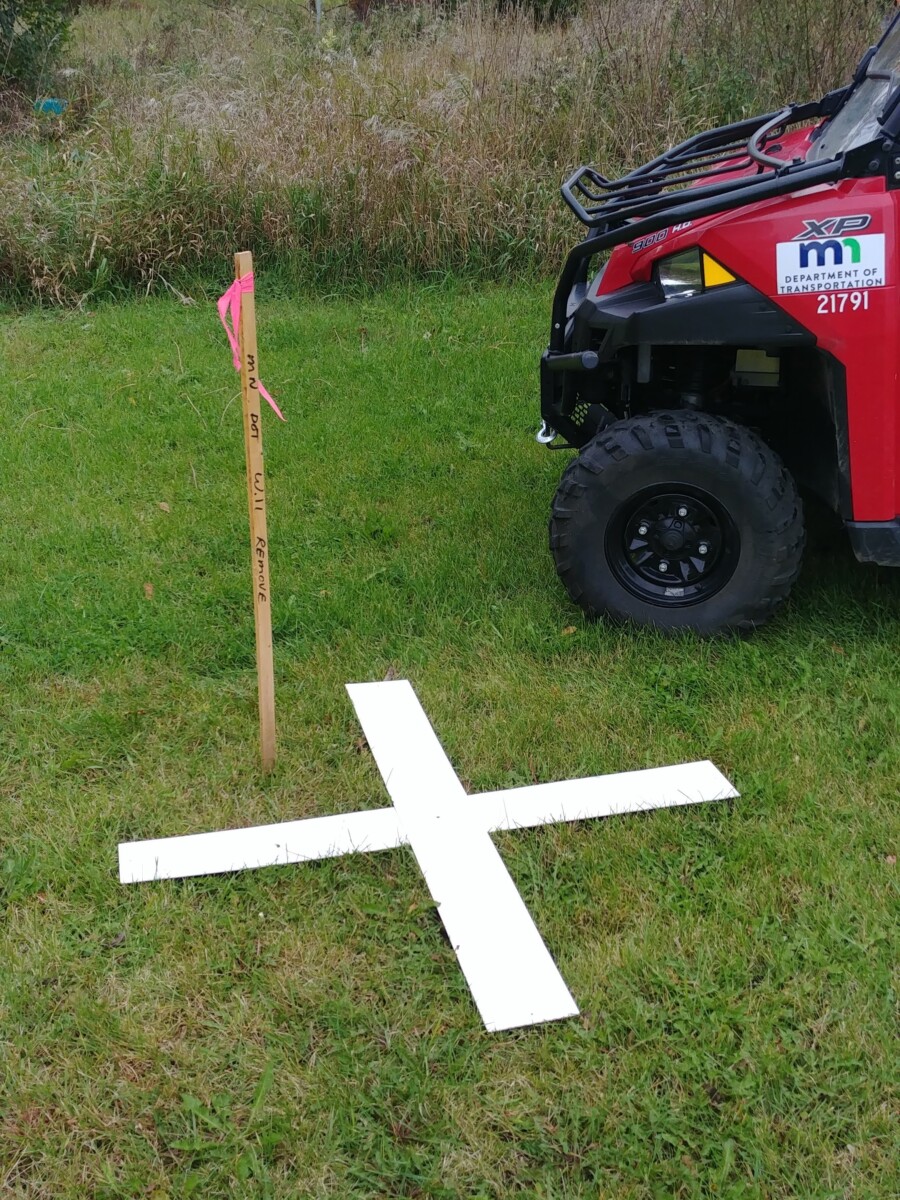
Photo Credit: MnDOT
The Minnesota Department of Transportation will soon begin aerial mapping of northwest Minnesota. The two points photographed are on Highway 2 in Fosston and Highways 2 and 75 near Crookston.
As this process starts, MnDOT requests that landowners do not disturb targets set up for aerial photographs. These targets that are set up near or on landowners’ properties will be contacted directly. The project is expected to begin in mid-May, weather-permitting.
The photos taken during the aerial surveying will reply on clear observations made. Therefore, it must be conducted after the leaves fall and before it snows. As a reference point for the photographer, the crew will place an “X” on the ground at the location. A white “X” will be placed on paved roads, and marks made out of plastic or fabrics will be placed on unpaved or gravel surfaces.
These pictures will be used to create a record of existing infrastructure and landscape for future plans of highway designs. If a target must be moved, MnDOT asks that landowners contact the District 2 survey office. They can call (218) 755-6509 to submit any concerns or inquiries.
Lakeland News is member supported content, please consider supporting Lakeland PBS today.
Support the Businesses That Support Lakeland PBS


